(UUID : e932254c-d840-4a8b-a620-d25b17a952f3)
 QR Code
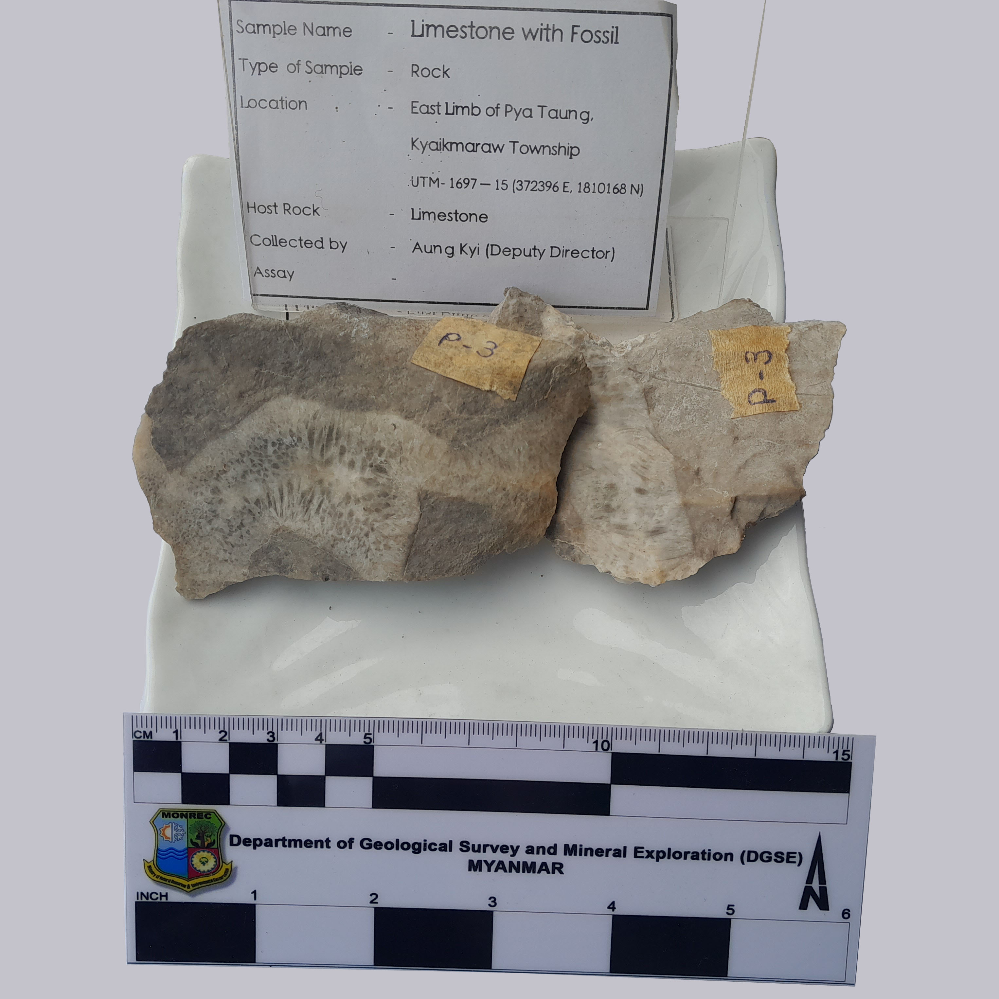
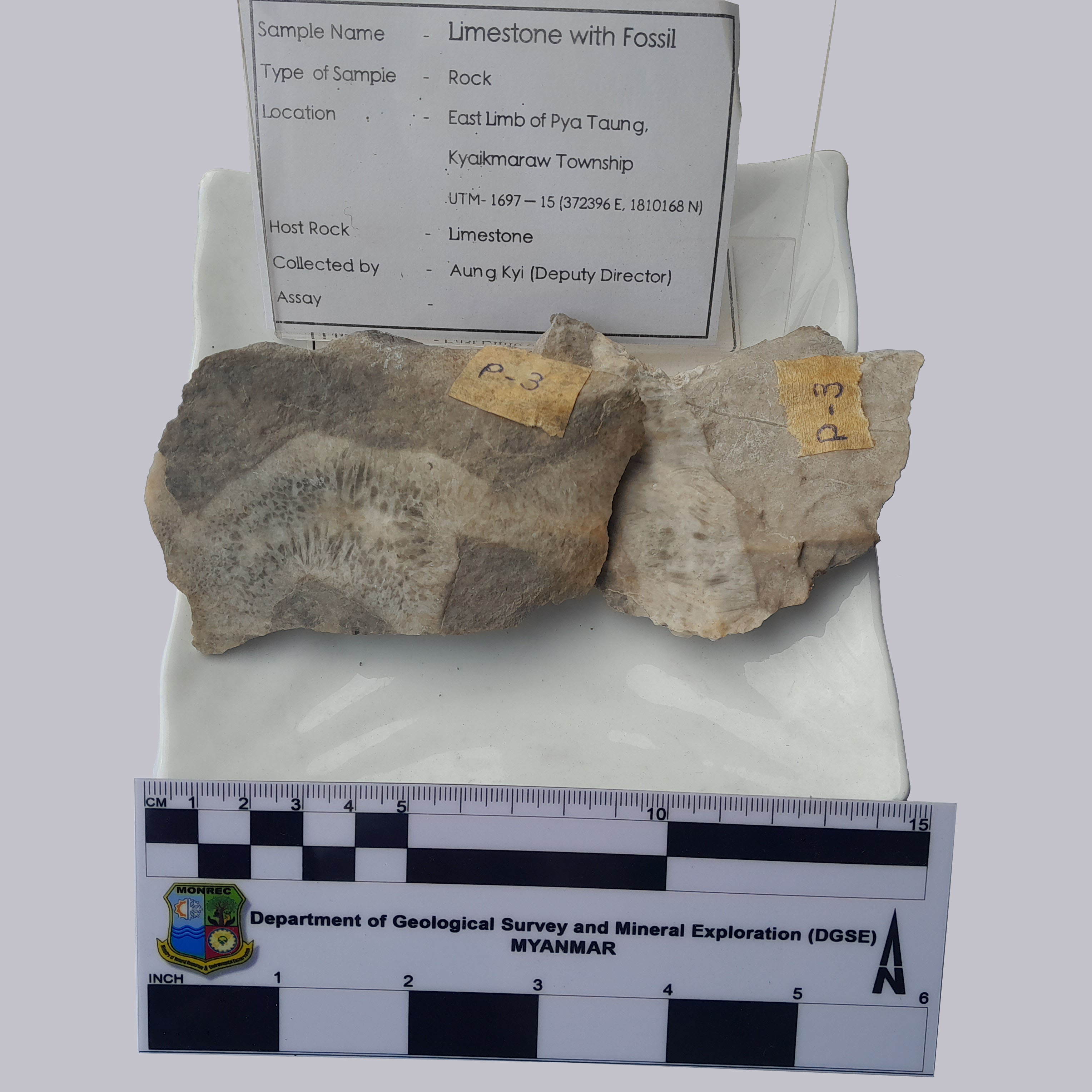
Sample Type of Object
Rock
Sample Name
Limestone with fossil
Sample ID (Self-granted ID)
MM_Rock_28_2023
Material
Rock
Field Name
Geological Survey in East limb of Pya taung(mountain), Kyeikmaraw township, Mon state
Sample Description
Milky white to grey color, fine to medium grained compact Limestone
Age
251.0 ~ 299.0
Age(unit)
Million Years (Ma)
Geological Age
Permian and older
Geological Unit
Moulmein Limestone
Collection Method
Manual
Collection Method Description
Mineral Database
Size
9 cm x 5 cm x 3 cm
Size(unit)
cm
Comment
Geological Survey in East Limb of Pya taung, Kyeikmaraw township, Mon state
Purpose
Museum
Tag
Elevation
331.2 ~ 401.2
Nav Type
GPS
Name of Physiographic Feature
Mineral Deposit Area
Location Description
East Limb of Pya taung area, Kyeikmaraw township, Mon state
Locality
Geological Survey in East Lamb of Pya Taung, Kyeikmaraw township, Mon state
Locality Description
"Moulmein Limestone, widely exposed in Karen and Mon states, and with the Tharabwin Limestone in Tanintharyi region of Myanmar. The Moulmein Limestone correlative with the Ratburi Limestone in Peninsular Thailand) of late Early Permian age and younger (Ueno & Charoentitirat 2011). While Mergui Group argillite, sandstone and diamictite crop out most widely in southern Myanmar, other units were also mapped there by Rao (1930). Rare hills of limestone occur, which he correlated with the Moulmein Limestone of the Mawlamyine (Moulmein) district further north. (The term ‘Moulmein Limestone’ was adopted by Bender (1983) based on the ‘Moulmein Beds’ described by Oldham (1856)."
Country
Myanmar (Burma)
State/Province
Mon state
City/Township
Kyeikmaraw township
Field Program/Cruise
Platform Type
Platform Name
Platform Description
Launch Type
Launch Platform Name
Launch ID
Collector/Chief Scientist
Mr. Aung Kyi (Deputy Director) and Field party (DGSE)
Collector/Chief Scientist Address
Department of Geological Survey and Mineral Exploration, Naypyitaw, [email protected]
Collection Date
Collection Time
Current Archive
Museum
Current Archive Contact
Original Archive
Museum
Original Archive Contact
Depth in Core
Core Depth(unit)
File Format
JPEG
File Title
Limestone with fossil_MM_Rock_28_2023
URL
URL Type
URL Description
Document File
CC License
CC BY-NC - The author is free to use, but not for profit.
Copyright
The copyright of this data is held by CCOP.
Data Registrant
Registration Date
2023-02-28

Copyright © CCOP Technical Secretariat
CCOP Building, 75/10 Rama 6 Road, Phayathai, Ratchathewi, Bangkok 10400 THAILAND