(UUID : 334bbc80-c930-4718-86c2-3eb428a4f882)
 QR Code
Sample Type of Object
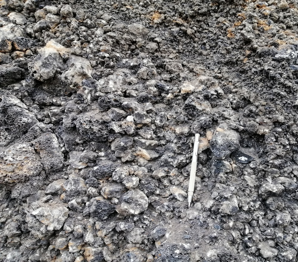
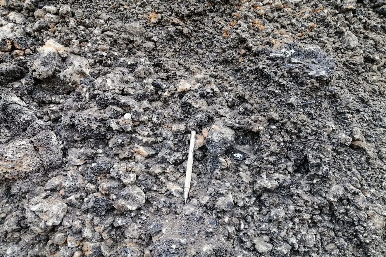
Rock
Sample Name
Pumiceous Basalt
Sample ID (Self-granted ID)
MM_Rock_29_2024
Material
Rock
Field Name
Geological Survey in Lay Thar taung area, Singu township, Mandalay division
Sample Description
Pumiceous basalt occurs in Lay Thar taung (mountain) area, Singu township
Age
0.0118 ~ 5.332
Age(unit)
Million Years (Ma)
Geological Age
Pliocene to Pleistocene
Geological Unit
Singu Basalt
Collection Method
Manual
Collection Method Description
Mineral Database
Size
Size(unit)
Comment
Geological Survey in Lay Thar taung area, Singu township, Mandalay division. (DGSE and Shwe Lin Kar Industrial Co., Ltd.
Purpose
Field report
Tag
Elevation
300 ~ 520
Nav Type
GPS
Name of Physiographic Feature
Plain
Location Description
Geological Survey in Lay Thar taung (mountain) area, Singu township, Mandalay division
Locality
Lay Thar taung area, Singu township, Mandalay division
Locality Description
At Singu, syn-tectonic Pleistocene basalts, possibly vented through the active fault strands, form a low elliptical plateau. The basalts overlie the upper part of the Plio-Quaternary Irrawaddy Group and straddle the fault trace (Chhibber 1934; Bender 1983; Bertrand et al. 1998). Apparent dextral offset of the south and north margins of the plateau across the fault by 2.7 and 6.5 km, respectively (Fig. 19.11a–c), has been considered to result from Quaternary displacement along the Sagaing Fault (Bertrand et al. 1998). Singu Basalt (Dark grey colored vesicular basalt) is on the Upper Miocene-Pliocene of Irrawaddy Formation and its equivalent.
Country
Myanmar (Burma)
State/Province
Mandalay division
City/Township
Singu township
Field Program/Cruise
Platform Type
Platform Name
Platform Description
Launch Type
Launch Platform Name
Launch ID
Collector/Chief Scientist
Aung Pe (Assistant Geologist) DGSE and Shwe Lin Kar Industrial Co., Ltd
Collector/Chief Scientist Address
myintsoedgse@gmail.com, gis.dgse@gmail.com
Collection Date
2022-02-17 ~ 2022-05-31
Collection Time
Current Archive
Database
Current Archive Contact
myintsoedgse@gmail.com, gis.dgse@gmail.com
Original Archive
Database
Original Archive Contact
myintsoedgse@gmail.com, gis.dgse@gmail.com
Depth in Core
Core Depth(unit)
File Format
JPEG
File Title
Pumiceous basalt_MM_Rock_29_2024
URL
URL Type
URL Description
Document File
CC License
CC BY-NC - The author is free to use, but not for profit.
Copyright
The copyright of this data is held by CCOP.
Data Registrant
Registration Date
2024-07-25

Copyright © CCOP Technical Secretariat
CCOP Building, 75/10 Rama 6 Road, Phayathai, Ratchathewi, Bangkok 10400 THAILAND